1 Ceres Information Page
Derived 1 Ceres Data
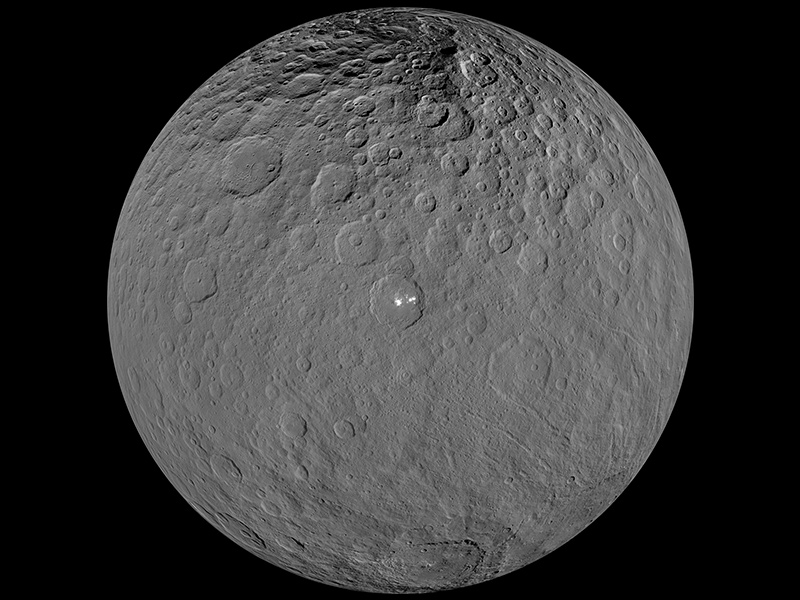
Higher-order data products related to a target of observation
| Title | Published | Start Date | End Date | ||
|---|---|---|---|---|---|
Dawn Ceres Gravity Science Derived Data Bundle | 2025 | 2/2/2015 | 2/2/2015 | ||
Many of the data sets listed in the table below are PDS3 legacy data sets. Once these data sets have been migrated to PDS4 they will be listed in the section above.
| Data Set Name | Data Set Description | Data Resource Page | Citation |
| Dawn GRaND Ceres Maps | This collection contains the Dawn Ceres high level map products including Water Equivalent Hydrogen (WEH) Map, Smoothed Water Equivalent Hydrogen (WEH) Map, Thermal & Epithermal Neutron Counts Map, Iron Concentration Map, and Iron Gamma Counts Map. These maps have been generated from the GRaND L1B data taken during the Ceres Low Altitude Mapping Orbit phase of the Dawn mission. | Browse |
"Prettyman, T.H. and N. Yamashita (2021). Dawn GRaND Ceres Bundle 1.0, urn:nasa:pds:dawn-grand-ceres::1.0, NASA Planetary Data System, https://doi.org/10.26033/hf9h-pt31."
|
| HST Images, Albedo Maps, and Shape of 1 Ceres | This dataset contains 267 HST ACS/HRC images of asteroid (1) Ceres obtained in 2003/2004 at three wavelengths, 535 nm, 335 nm, and 223 nm. They have been photometrically calibrated to standard reflectance unit I/F. The dataset also includes a shape for Ceres, as well as three surface albedo maps covering the area between +/-50 deg latitude, derived from these images. | Browse |
"Li, J.-Y., Young, E. F., Thomas, P. C., Parker, J. Wm., McFadden, L. A., Russell, C. T., Stern, S. A., and Sykes, M. V., HST Images, Albedo Maps, and Shape of 1 Ceres V1.0. EAR-A-HSTACS-5-CERESHST-V1.0. NASA Planetary Data System, 2006."
|
| Dawn VIR Ceres Global Mosaics | This data set contains global mosaics of the Dawn VIR band centers and depths of phyllosilicate absorption bands, located at 2.7 (OH band) and 3.1 microns (NH4 band), from the Ceres encounter. The data set was acquired during the Survey and Ceres Science RC3 (CSR) phases between 2015-04-25 and 2015-06-27. | Browse |
"De Sanctis, M.C., M.T. Capria, E. Ammannito, A. Frigeri, F. Tosi, M. Giardino, S. Fonte, F. Zambon, DAWN VIR DERIVED CERES GLOBAL MOSAICS V1.0, DAWN-A-VIR-5-DDR-CERES-MOSAIC-V1.0, NASA Planetary Data System, 2018."
|
| Dawn Shape Models of Ceres | This page provides links for shape models and DTMs of Ceres based on Dawn data, produced by the FC team, the Gravity team, and others. | Browse |
""
|
| Dawn Framing Camera Ceres Image Mosaics | This accumulating data set includes Ceres global mosaics and quadrangles derived from images acquired by the Framing Camera 2 (FC2) on the NASA Dawn spacecraft. Global mosaics are provided in cylindrical and polar stereographic projections. The quadrangle mosaics use Mercator (equatorial), Lambert conformal (mid-latitude) and stereographic projections. Clear and color mosaics are provided for high altitude mapping orbit (HAMO) and clear filter mosaics only in the low altitude mapping orbit (LAMO) science phases. | Browse |
"Roatsch,T., E. Kersten,K.-D. Matz,F. Preusker, F. Scholten, S. Elgner, S.E. Schroeder, R. Jaumann, C.A. Raymond, C.T. Russell, DAWN FC2 DERIVED CERES MOSAICS V1.0, DAWN-A-FC2-5-CERESMOSAIC-V1.0, NASA Planetary Data System, 2016."
|